Hello, I’m Erin Bell. I’m an environmental data and GIS professional. I’m completing an MSci in Environmental Sustainability at University College Dublin (2027), with a BS in Wildlife and Fisheries Biology and a BA in Cultural Anthropology. Download my CV or get in touch – erinchristinebell (at) gmail.com
Storymap – The Green Deal Restoration Cluster
Storymap Link
Interactive StoryMap for WaterLANDS, reviewed and approved by the European Commission. Multi-institutional, international project with 149 Partners, 46 Restoration Sites, and 4 Lead Organizations.
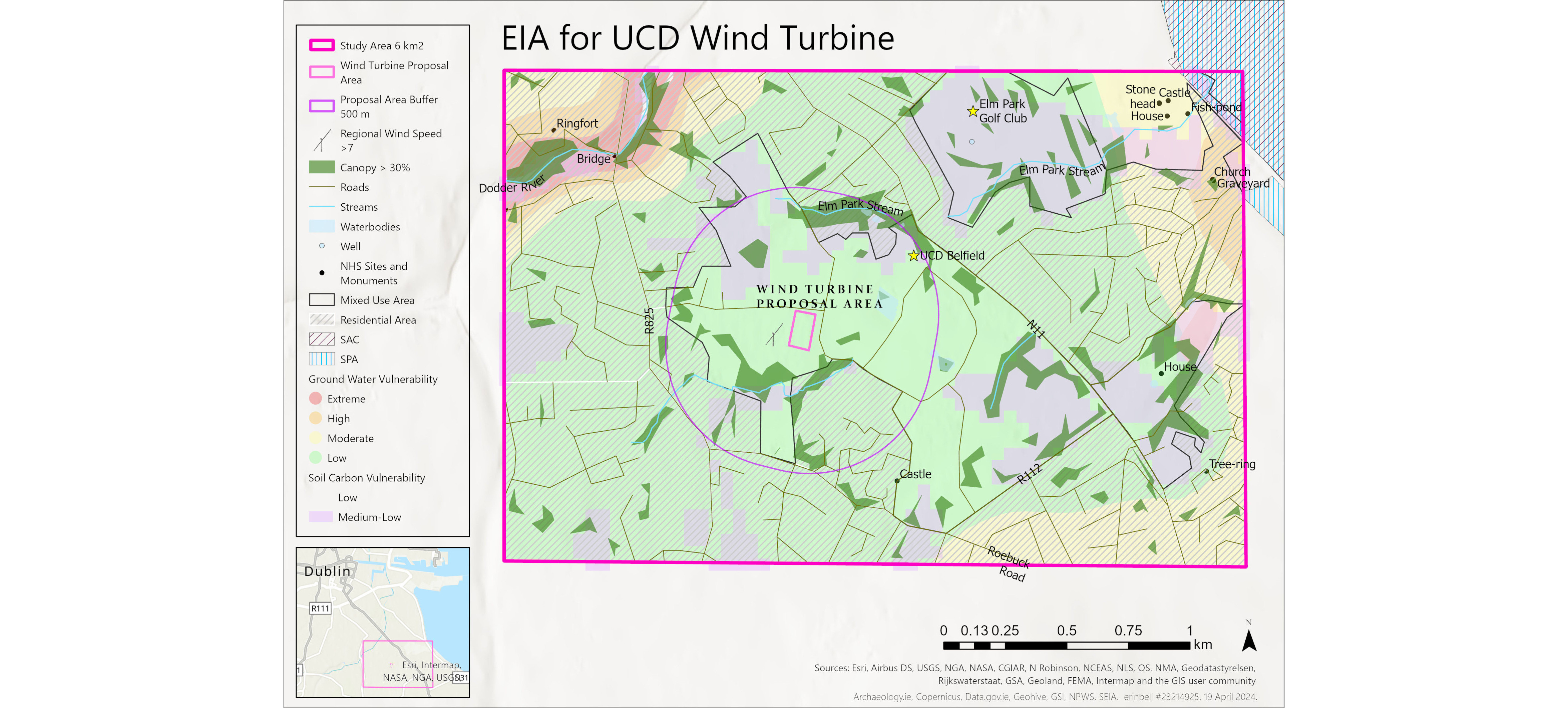
Environmental Impact Assessment – Wind Turbine – University College Dublin
UCD module exercise. Consideration of wind activity and impact on residential and day-use activity, heritage sites, catchment-level hydrology, soil carbon, Natura 2000 site proximity, vegetation canopy, and sensitive species and habitat.
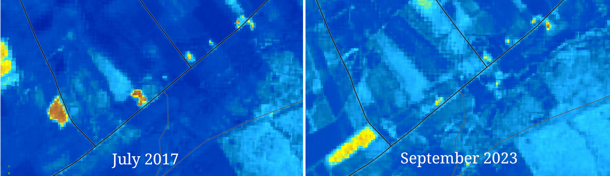
Normalized Difference Moisture Index – Time Lapse – Green Sod
Map series including NDMI Sentinel 2 imagery and Google Earth Engine time lapse video, regional river water quality, property aspect, elevation, slope, soil carbon, and soil pH.
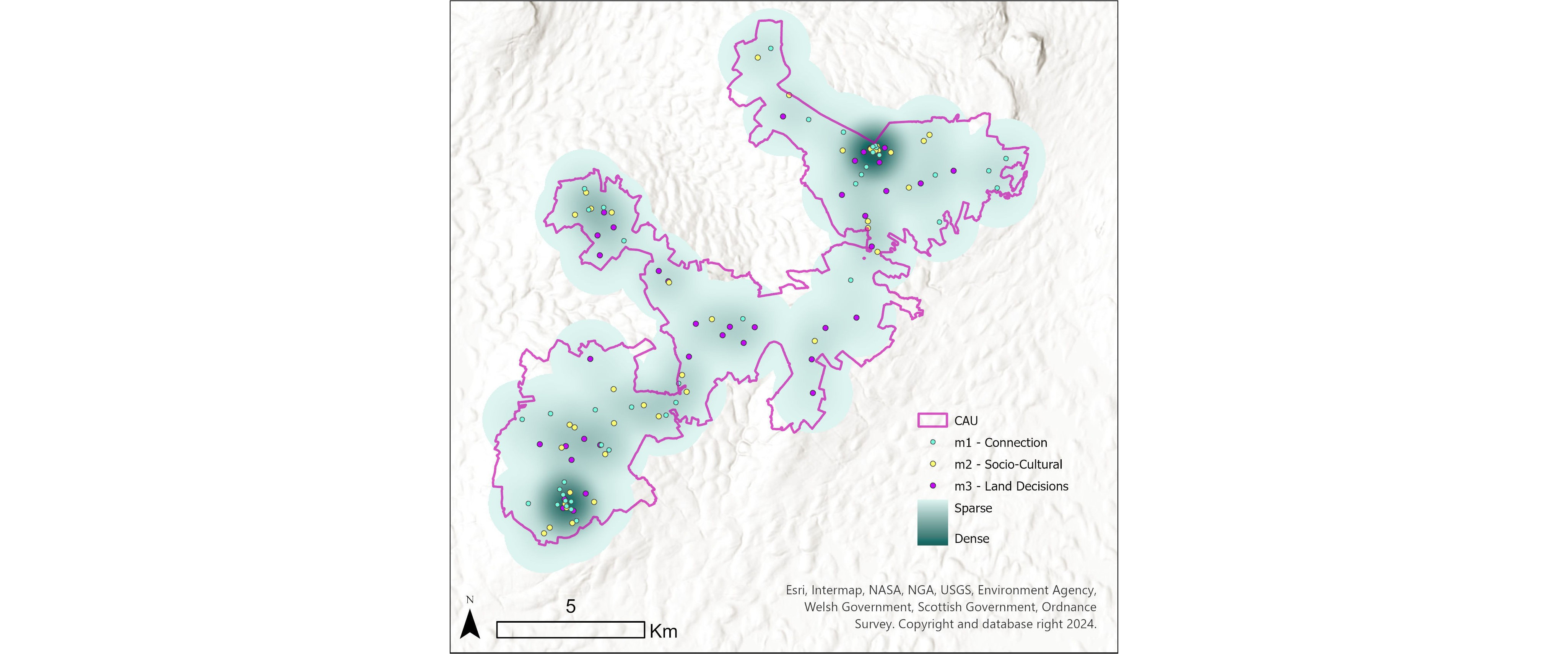
Participatory Mapping Survey – Cuilcagh-Anierin Uplands
Results Link
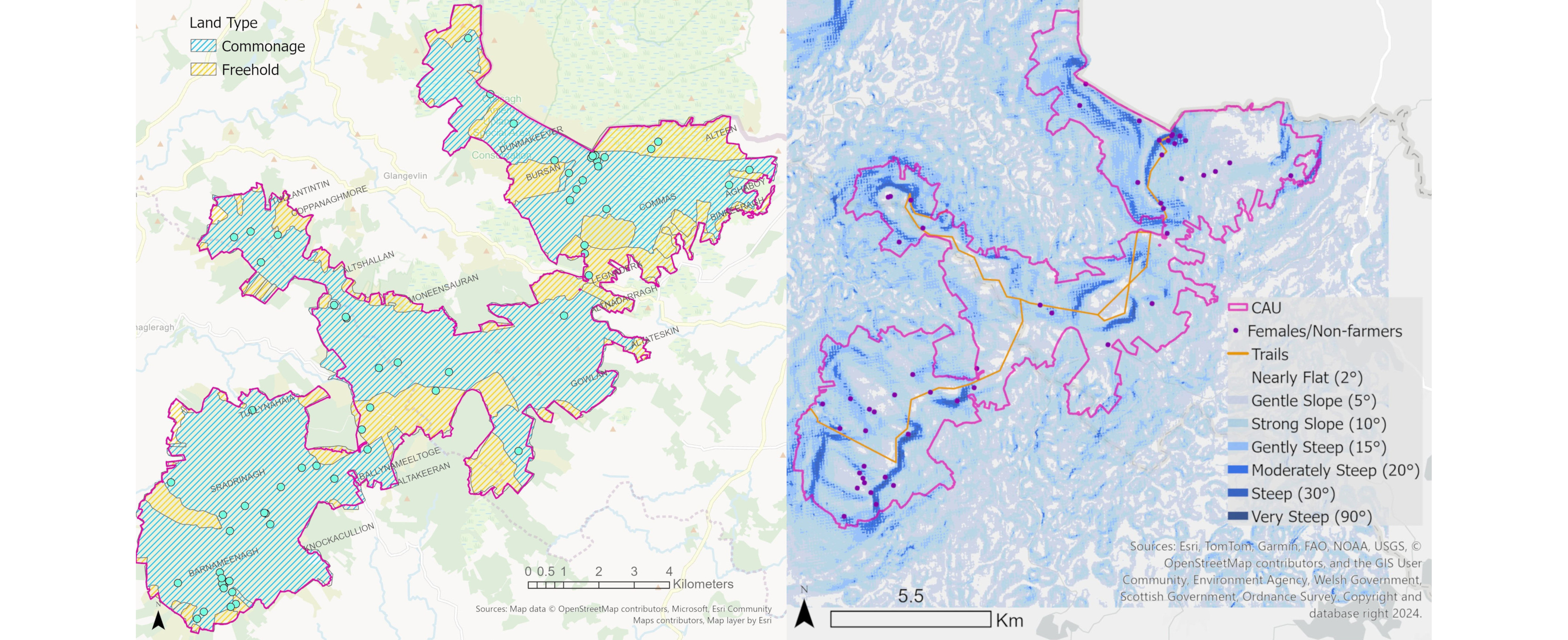
Locals mapped areas of personal connection, socio-cultural importance, and areas where they held particular interest in landscape decisions. Part of MSci thesis Meaningful Inclusion and Structural Exclusion: Agri-Scheme Restoration in an Irish Context.
Statistical Analysis – R
Thesis Link
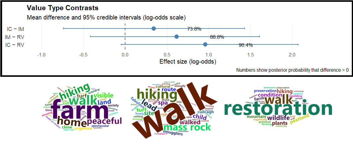
Bayesian cumulative logit models for probability of Relational (RV), Intrinsic (IC), or Instrumental (IM) environmental values receiving a stronger agreement response, compared to another value. Weighted word frequency clouds.
Geospatial Statistical Analysis
Thesis Link
Cluster bootstraps compare point density difference, with weight-adjustment accounting for number of points created per participant. Wicoxon-Signed Rank tests compare participants with random point set, finding slope preference difference. Markov Monte Carlos test subgroup difference (ie Farmer vs Non-farmer).
Storymap – Sustainable Land and Water Resources REU
Storymap Link
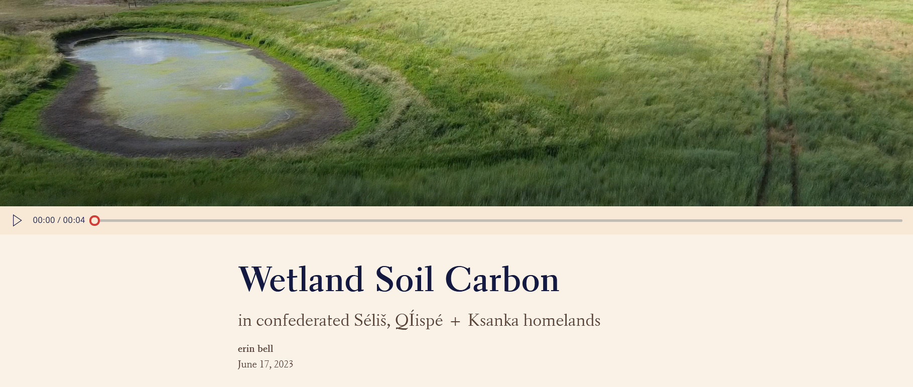
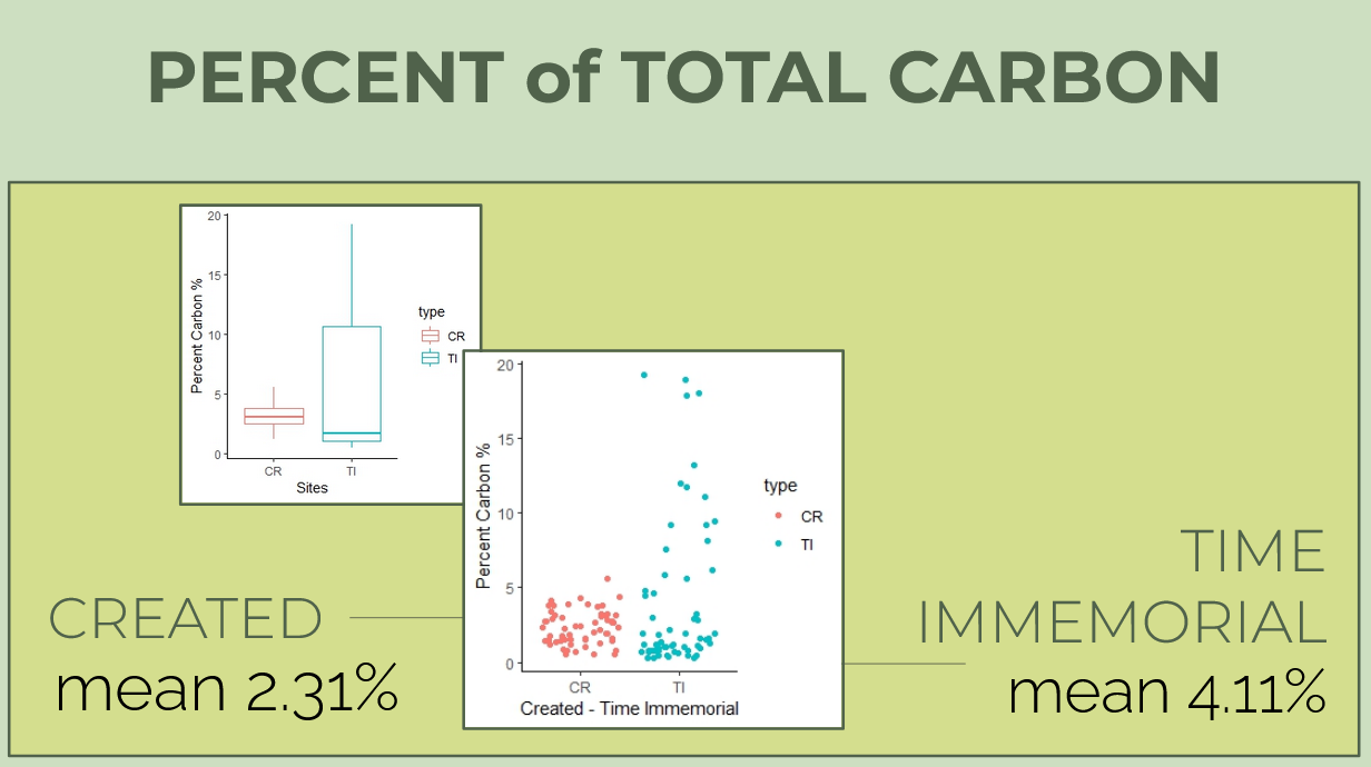
Community-Based research with the Confederated Salish and Kootenai Tribes. Comparing Time Immemorial wetland soil carbon with Created wetlands.
Slide Presentation
Community-based BSci thesis, Comparing Time Immemorial wetland soil carbon with Created wetlands, formatted for PowerPoint presentation.

Poster Presentation
Poster Link
Complex soil carbon dynamics with cultural context created for conference presentation.
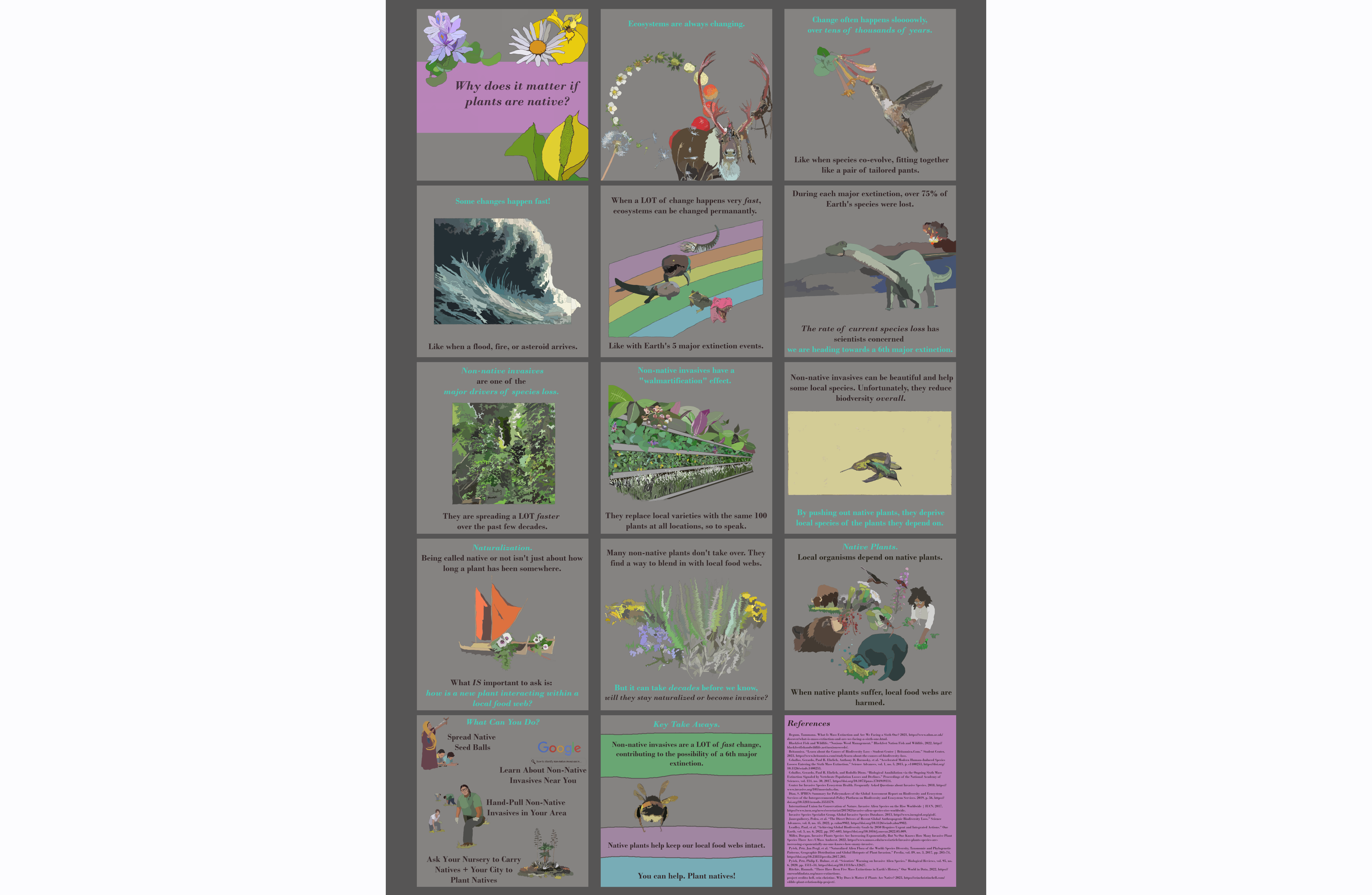
Science Communication – Native Plants Poster
Graphic novel-style visualization to convey complex science concepts about the importance of native plants.
Spatial analysis – Participatory mapping – Community-based research – Environmental assessment – Remote sensing – Storymaps – Statistical analysis

